
Research School of Earth Sciences
Geodynamics Group
Antarctic GPS Project
Geodetic Monitoring of Isostatic Rebound near the Lambert Glacier
The Geodynamics Group is undertaking a 5 year program to monitor the postglacial
rebound which may be occurring near the Lambert Glacier, Prince Charles Mountains,
Antarctica since the Last Glacial Maximum. A transect of permanent GPS sites
has been established from the coast up to 450 km inland. The aim of the project
is to estimate absolute vertical velocities of the sites and, coupled with other
geophysical data, to discriminate between several different ice models for the
Antarctic continent.
Contact Paul Tregoning for further details on this project.
NEW: Inclusion of
Iridium satellite modems
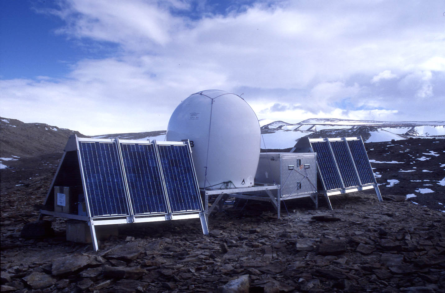
In January, 1998 we installed a remote GPS system near Beaver Lake, Antarctica
to commence a long term postglacial rebound monitoring program. The
equipment operated successfully from 12 January to 23 March, 1998 at which
time there was insufficient solar power available to operate the equipment.
A second solar-powered system was installed on 22 January 1999 to replace
the system which wintered the previous year. 37 days of data were
recorded before the receiver memory filled.
In 2000 we increased the complexity of the equipment to include satellite
phone communications and winter power provided by hydrogen fuel cells. We also
installed two new sites at Dalton Corner and Landing Bluff. In December 2001 the
Landing Bluff site commenced daily operations, transmitting GPS data back to
Australia on a daily basis. The equipment operated until May 2001 at which time
there was insufficient solar power to continue operation.
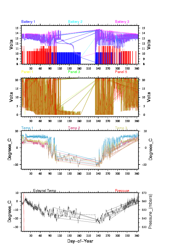
In 2002 the sites at Landing Bluff and Beaver Lake began reliable, automatic
operation and, as at 18 March 2002, are downloading GPS and system diagnostic data
and transmitting the data back to RSES on a daily basis. The system diagnostic data
can be viewed for
Landing Bluff and
Beaver Lake and is updated on a daily basis.
Return to RSES Home Page
Last modified:2002 August 23 pault@rses.anu.edu.au
2002-03 fieldwork
2002 Images from Komsomolskiy Peak
As part of the Ocean.US oceanographic project, two Iridium L-Band transmitters
have been provided to RSES for installation at remote GPS sites in Antarctica.
These satellite modems will be installed at Dalton Corner and Komsomolskiy Peak,
two sites that are too far south for the Inmarsat data transmission system to
work reliably. The use of the Iridium satellite modems will permit data to
be transmitted from these two remote sites on a daily basis back to RSES.
1998
2000/01
2001/02
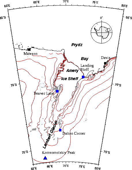
Figure 1. Site map showing the location of the GPS sites at
Beaver
Lake and nearby Auslig sites of Mawson and Davis.