Amery Ice Shelf & Lambert Glacier maps
- Beaver Lake 1:100,000 Satellite image 395kB
- Beaver Lake 1:100,000 Topographic Map 169kB
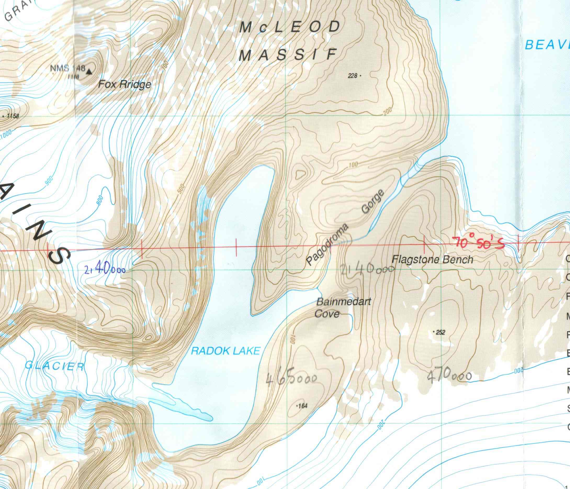
- Beaver Lake 1:50,000 Topographic Map enlargement 257kB
- Beaver Lake 1:500,000 Satellite Image 392kB
- Landing Bluff 1:100,000 Satellite image 170kB
- Landing Bluff 1:25,000 Satellite image enlargement 144kB
- Prince Charles Mountains (North) 1:1,000,000 line map 275kB
- Prydz Bay 1:1,000,000 line map 221kB
- Amery Ice Shelf 1:1,000,000 line map 185kB
- Upper Lambert Glacier to Komsomolskiy Peak 1:1,000,000 line map 190kB
- Prince Charles Mountains (South) 1:1,000,000 line map 219kB
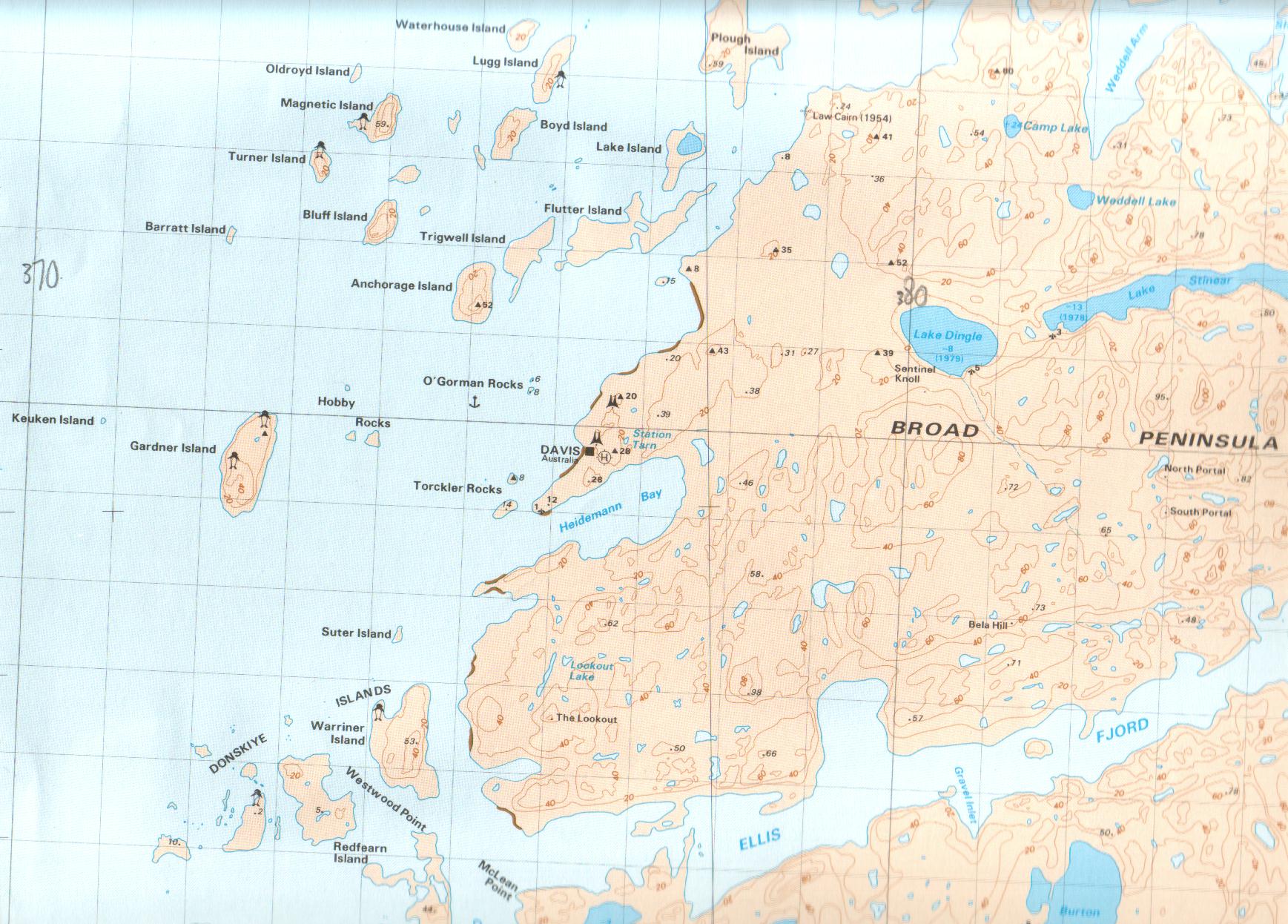
- Davis Station 1:50,000 topographic map 348kB
- Dalton Corner 1:100,000 Satellite image 325kB
- Mawson Coast 1:1,000,000 IMW map 147kB
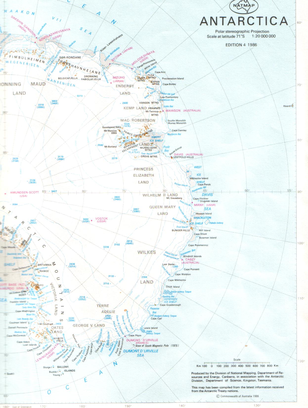
- Eastern Antarctica 1:20,000,000 General map 268kB
Return to Homepage
Last updated: 15th October 2001